Raster mapping
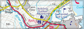
1:25,000 raster activity maps
Award winning series of six 1:25,000 scale raster maps tailored to outdoor leisure activities . Available in jpg, tiff and ecw formats.
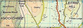
1:50,000 raster mapping
Providing a digital equivalent to the popular Discoverer Series, each of the 54 tiles covers 20 x 20 km . Each tile is provided with a full colour version with grids, a low colour version and with a townlands map. Available in jpg, tiff and ecw formats.
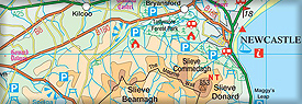
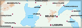
1:250,000 raster mapping
Small scale regional raster map that is cartographically identical to the Ireland North paper map. A black and white outline version is included. Available in jpg, tiff and ecw formats.
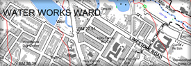
1:10,000 raster mapping
Most detailed OSNI raster product derived directly from the large scale database. Full coverage of Northern Ireland. Available as individual tiles in tiff format.
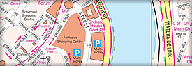
Belfast Raster street map
Detailed 1:12,000 scale city map of Belfast with gazetteer of street names. Available as jpg, tiff and ecw format.
1:1,000,000 raster mapping
Smallest scale OSNI raster product offering an excellent overview of Northern Ireland's infrastructure, adminstrative boundaries and natural environment. This product has been withdrawn from sale and is now available under Open Government Licence. Please visit https://www.opendatani.gov.uk/